12 Jyotirlinga Yatra by Car: Every Road, Real Driving Times and Cost
About 8,300 km and 165 hours at the wheel, and the order everyone drives is 1,000 km longer than it needs to be. Every leg with its real driving time, the two roads with gates, Uttarakhand’s rules for your car, and what fuel, tolls and a hired car actually cost.

The road to Kedarnath ends at Sonprayag, sixteen kilometres short of the shrine. Photo: Rohit Sharma · CC BY-SA 4.0 · Wikimedia Commons

Contents
- Five things that changed, which most road guides still get wrong
- The short answer
- The circuit, leg by leg
- The order everyone drives costs about 1,000 km
- Where the map lies
- Uttarakhand has rules for your car
- What the driving costs
- Your car, a hired car, or a self-drive rental
- Fuel, parking and the things nobody publishes
- What pilgrims ask
- Related reading
- Sources and confidence
A car is the only way to do the twelve Jyotirlingas on your own timetable. It is also the only way to reach Bhimashankar and Srisailam without surrendering a day to a bus, and the only way to carry a family, a wheelchair or a week of luggage between them.
What a car does not do is make the yatra short. Shrine to shrine the circuit is about 8,300 km of road, and roughly 165 hours behind the wheel. At a sane seven hours of driving a day, that is 24 days of driving alone, before a single darshan, a rest day, or the Kedarnath trek. Most operator itineraries advertise twelve to fifteen days. That gap is the whole story of this article.
Gaadi nikaalne se pehle, paanch cheezein badal chuki hain, aur inmein se ek bhi aapko purane blogs mein nahi milegi.
Before the routes, five things have changed on these roads, and almost nothing written about driving this circuit reflects them.
Five things that changed, which most road guides still get wrong
1. The highway numbers in old guides point at different roads now. India renumbered its national highways by gazette notification in April 2010, and two of the numbers most often quoted for this yatra were reused. Old NH-7, the Varanasi–Kanyakumari spine, is now NH-44; today's NH-7 is the Rishikesh–Mana road you take towards Kedarnath. Old NH-8, Delhi–Ahmedabad–Mumbai, is now NH-48; today's NH-8 runs between Assam and Tripura. A 2009 blog telling you to "take NH-7 south from Varanasi" and a 2026 signboard reading NH-7 point in opposite directions. Old NH-3, the Agra–Bombay road through Indore and Nashik, no longer exists at all: it is now NH-44, NH-46, NH-52, NH-60 and NH-160 in sections.
2. Aurangabad is Chhatrapati Sambhajinagar, and there is a second Aurangabad. The Grishneshwar and Ellora base city was renamed by Maharashtra gazette notification on 16 September 2023, and the railway station code is now CPSN. The trap is that a different Aurangabad, in Bihar, sits on the Grand Trunk Road squarely along the Varanasi → Deoghar leg, and it was not renamed. Type the bare name into a satnav on that leg and you can be sent hundreds of kilometres the wrong way.
3. The Ganga Expressway opened on 29 April 2026, and it changes the hardest transfer on the circuit. The 594 km Meerut–Prayagraj expressway now carries about a third of the Deoghar → Haridwar drive. That is the difference between the run up to Kedarnath being a brutal three days and a hard two. Read the caveat, though: the expressway stops at Prayagraj and does not serve Varanasi. It helps you leave the east; it does nothing for Varanasi → Deoghar.
4. Samruddhi Mahamarg is finally continuous. The last 76 km of the Mumbai–Nagpur expressway, Igatpuri to Amane, opened on 5 June 2025, including a 7.8 km tunnel through the Western Ghats. Its interchanges at Igatpuri, Sinnar, Shirdi and Chhatrapati Sambhajinagar reshape the Nashik ↔ Ellora legs. One correction while we are here: it runs through Nashik district, not Nashik city. Your access is Igatpuri or Sinnar.
5. You cannot drive across the new Pamban bridge, and you never could. The vertical-lift bridge that opened on 6 April 2025 with so much coverage is a railway bridge. Road traffic to Rameswaram uses the separate road bridge alongside, opened in 1988. Several guides now invite you to drive over India's first vertical-lift sea bridge. You cannot.
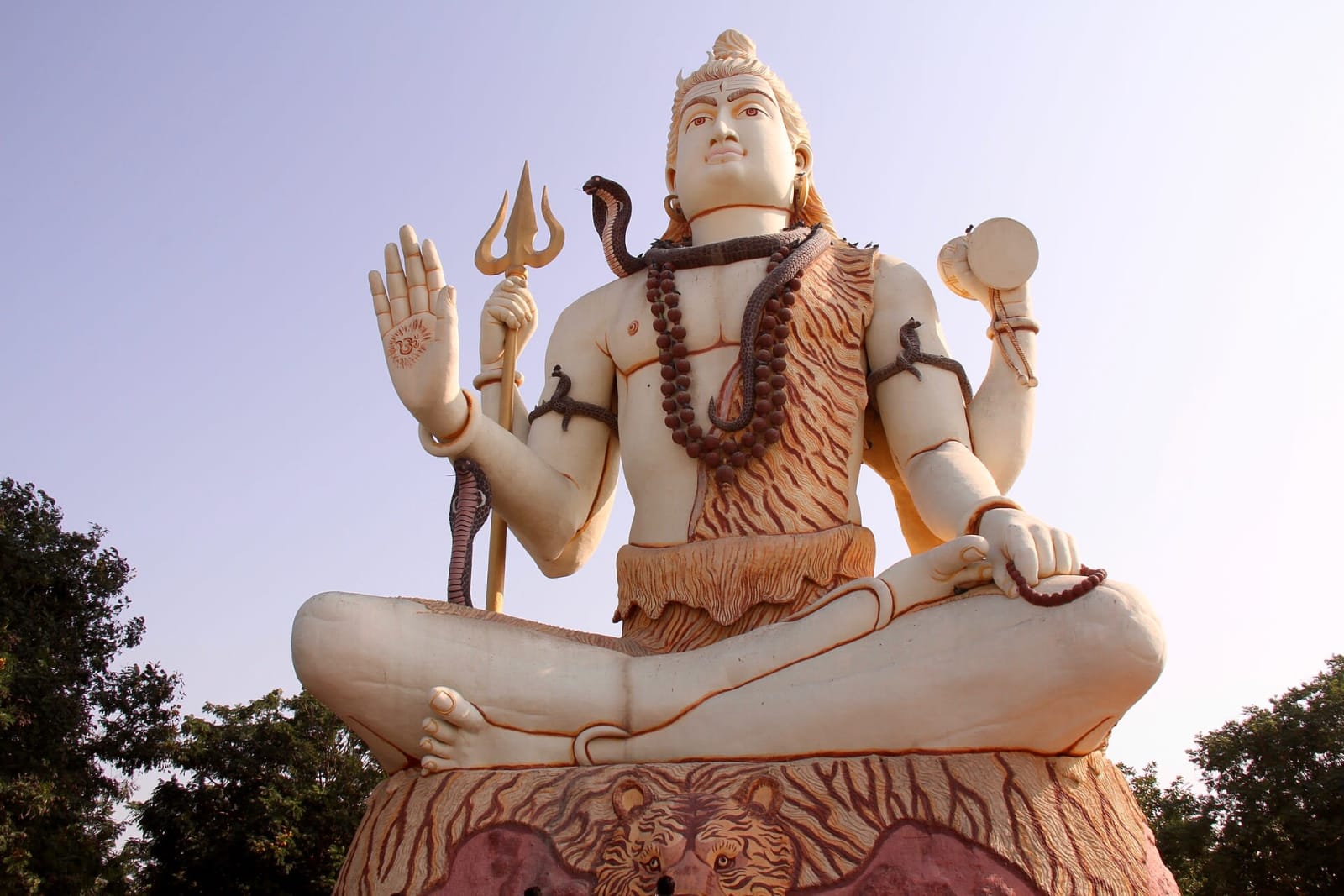
Nageshwar, between Dwarka and Bet Dwarka. Since February 2024 the island is a bridge away, not a ferry. Photo: TeshTesh · CC BY-SA 4.0 · Wikimedia Commons

And a sixth, for the Gujarat leg: Beyt Dwarka is no longer a ferry trip. Sudarshan Setu, the 2.32 km cable-stayed bridge from Okha, was inaugurated on 25 February 2024. Every guide written before that tells you to queue for a boat.
The short answer
Ab asli sawaal: kitne kilometre, kitne din, aur kitna kharcha.
- About 8,300 km of road for the twelve, in the order most people drive them.
- About 165 hours at the wheel, so 24 days of pure driving at seven hours a day. Realistically 30 to 35 days door to door once darshan, rest and Kedarnath are in.
- Roughly ₹58,000 of petrol for a car doing 15 km a litre, or about ₹45,000 of diesel at 18 km a litre. Tolls and everything else are on top.
- One shrine no car reaches. The road ends at Sonprayag; Kedarnath is 16 km further on foot, by pony or by helicopter.
- Two roads with gates. The Nallamala forest road to Srisailam is shut 9 PM to 6 AM, and every Char Dham route in Uttarakhand is closed to passenger vehicles, private cars included, from 10 PM to 4 AM.
If you want those numbers for your own town and your own car, the car yatra calculator drives the loop from where you live, with the hours, the nights and the fuel worked out.
The circuit, leg by leg
Distances below were routed twice, through two independent engines running on OpenStreetMap data, and cross-checked against published road distances where any exist. The realistic drive column is our estimate, not a sourced figure: it is the routed distance at 55–60 km/h on four-lane highway, 40–45 on two-lane state road and 25–30 on ghat sections. Which is to say: what a maps app tells you, plus thirty to forty per cent for fuel stops, food, town traffic and the fact that nobody drives a pilgrimage at the speed a routing engine assumes.
| Leg | Road km | Realistic drive | Main highways |
|---|---|---|---|
| Somnath → Nageshwar (Dwarka) | 252 km | 4.5–5 h | NH-51 for 232 km |
| Nageshwar → Mahakaleshwar (Ujjain) | ~890 km | 14–16 h · two days | NH-27, then NH-47 for 532 km |
| Mahakaleshwar → Omkareshwar | 135 km | 3–4 h | NH-347BG, SH-59 |
| Omkareshwar → Trimbakeshwar (Nashik) | 441 km | 8–9 h | NH-52, NH-60 |
| Trimbakeshwar → Bhimashankar | 237 km | 5.5–6.5 h | NH-60, SH-53 |
| Bhimashankar → Grishneshwar (Ellora) | 303 km | 6.5–7.5 h | Samruddhi Mahamarg for 118 km |
| Grishneshwar → Srisailam (Mallikarjuna) | 764 km | 13–15 h · two days | NH-765, NH-52, NH-65 |
| Srisailam → Rameswaram | 944 km | 17–20 h · two days | NH-40, NH-38, NH-87 |
| Rameswaram → Kashi Vishwanath | 2,361 km | 40–48 h · three to four days | NH-44 for 826 km |
| Kashi Vishwanath → Vaidyanath (Deoghar) | 471 km | 9–11 h | NH-19, NH-33, NH-333 |
| Vaidyanath → Haridwar | 1,278 km | 22–26 h · two days | Ganga Expressway for 428 km |
| Haridwar → Sonprayag (road end for Kedarnath) | 235 km | 7–9 h | NH-7, NH-107 |
Four legs are 750 km or longer, and one of them, Rameswaram to Varanasi, is 2,361 km. That is the length of London to Moscow. Together those five legs are about 6,200 km, three-quarters of the entire circuit, and not one of them has a shrine in the middle of it.
Yaani aadha se zyada safar sirf ek dham se doosre dham tak pahunchne mein nikal jaata hai.
Work it out for your own town
The circuit above starts at Somnath because the list does. Yours starts where you live. The calculator drives the loop from your own town and back, with the hours at the wheel, the nights on the road and the fuel and tolls for your car.
The order everyone drives costs about 1,000 km
The conventional order (Somnath, Nageshwar, Ujjain, Omkareshwar, Trimbakeshwar, Bhimashankar, Grishneshwar, Srisailam, Rameswaram, Varanasi, Deoghar, Kedarnath) is the order the Shiva Purana's naming shloka suggests and the order almost every operator sells. We pulled the full twelve-by-twelve road-distance matrix and optimised it. The conventional order comes to about 8,200 km. The shortest order that still finishes at Kedarnath, which is where most people want to finish, comes to about 7,170 km.
The order you will be sold is roughly 1,040 km longer than it needs to be: about two extra days of driving. The reason is simple: it sends you south to Rameswaram and then straight back north, crossing the country twice. Starting in the far south and working north-west, then north-east, crosses it once.
Seedha matlab: do din extra, sirf isliye ki list purani hai.
Whether that matters is your call. There is a real argument for the traditional order, and for ending at Kedarnath rather than beginning there. But nobody should pay for two extra driving days without being told they are paying for them.
Where the map lies
Yahin par map sabse zyada dhokha deta hai.
Trimbakeshwar to Bhimashankar is the worst offender on the circuit. The two shrines are 95 km apart in a straight line. The road distance is 237 km, two and a half times as far. There is no through road across the Sahyadri crest between them, so you go east to Nashik, south down NH-60 through Sangamner and Narayangaon, then back west and up the ghat. Two hours on the map; the better part of a day in the car.
Bhimashankar to Grishneshwar looks like a half-day at 303 km, but the first stretch is the ghat descent. Budget six and a half to seven and a half hours.
Haridwar to Sonprayag is 235 km and takes seven to nine hours, under 30 km/h, because it is continuous hill road from Devprayag onwards. And Sonprayag is not Kedarnath. Private vehicles stop there; a state-run shuttle of around 220 maxi cabs covers the last 5 km to Gaurikund at ₹50 a head, and from Gaurikund the shrine is a 16 km climb on foot. The district administration's own 2026 page says 17 km; the government's ropeway papers say 16. Either way it is six to nine hours up.
A ropeway was approved in March 2025: ₹4,081 crore, 12.9 km, Sonprayag to Kedarnath, about six years of construction. It will not exist for your trip.
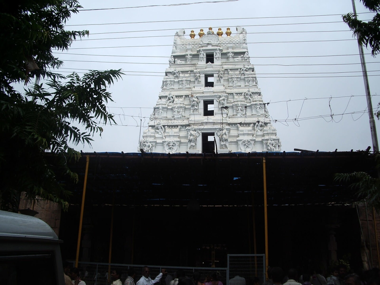
Srisailam sits inside a tiger reserve, and the road to it keeps the reserve's hours. Photo: Chintohere · Public domain · Wikimedia Commons

The Nallamala forest road to Srisailam has a gate, and it closes. The ghat road crosses the Amrabad tiger reserve and is shut to all traffic, motorcycles included, from 9 PM to 6 AM. Checkposts at Mannanur on the Telangana side and Dornala on the Andhra side. Inside the reserve the limit is 30–40 km/h, enforced; photography in the core is prohibited; and OpenStreetMap records no fuel station in the whole 102 km crossing. Reach Mannanur by 8 PM or wait for dawn. Mobile coverage inside is poor to non-existent, so download your maps before Kalwakurthy.
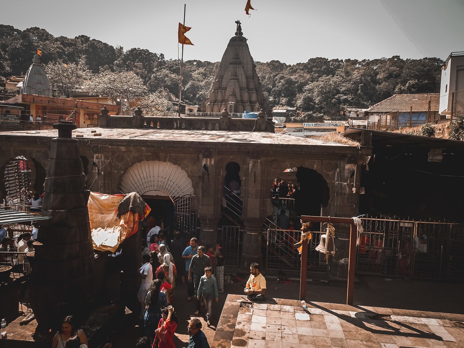
Bhimashankar, 110 km from Pune and three and a half hours of it. Photo: Mechatron00 · CC BY-SA 4.0 · Wikimedia Commons

Bhimashankar, by contrast, is a drive you can actually complete. Pune to the temple is 110 km, three to three and a half hours in practice, not the 1 h 40 m a routing engine promises. The ghat is paved for its full length with adequate passing places, and the car park is a five-minute flat walk from the temple. The treks from Khandas are an optional activity, not the price of darshan, whatever the operator pages imply. What you do need is the online registration Bhimashankar now requires before darshan. Do it before you drive the ghat, not after.
Uttarakhand has rules for your car
Kedarnath, 16 km beyond where any car can go. Photo: Rohit Sharma · CC BY-SA 4.0 · Wikimedia Commons
This is where self-drivers get caught, because the rules are real, official and rarely mentioned in yatra blogs. Aur haan, inka palan sach mein karwaya jaata hai.
- Registration covers your vehicle, not just you. Uttarakhand's Char Dham registration portal requires you to register yourself and your vehicles before starting. It is free, it produces a QR letter to show at each shrine, and it applies to private cars.
- No passenger vehicle may move between 10 PM and 4 AM on Char Dham routes, private cars included, on an order issued in 2026. The transport department's own advisory goes further: do not drive hill routes before 5 AM or after 7 PM.
- Oversize vehicles are banned outright. Anything with a wheelbase over 4,225 mm or width over 2,500 mm may not operate on yatra routes. This is what strands a long-wheelbase tempo traveller hired by a large family group, so check the vehicle before you book it.
- No driver may be at the wheel more than eight hours in a day, by rule.
- Commercial vehicles additionally need a Green Card and trip card before a religious tour. Your own car does not, but a hired one must have it, and that is the operator's job to produce.
Through July to September, the Kedarnath yatra is suspended for a day or three at a time whenever the IMD issues an alert. On 17 July 2026 heavy rain damaged the foot route in several places and all helicopter operations were halted until further notice, with the District Magistrate telling pilgrims not to set out. Build slack into that leg or plan it outside the monsoon.
What the driving costs
Fuel prices moved in 2026, after twenty-six months of not moving. Any guide that says Indian pump prices have been frozen since 2024 is out of date: four increases between 15 and 25 May 2026 took Delhi petrol from ₹94.77 to ₹102.12 and Delhi diesel from ₹87.67 to ₹95.20. They have been flat since. These are from the government's own daily price series.
| City on the circuit | Petrol | Diesel |
|---|---|---|
| Ahmedabad (Gujarat) | ₹101.83–102.58 | ₹97.92–98.70 |
| Pune (Maharashtra) | ₹111.55–111.90 | ₹98.22 |
| Indore (Madhya Pradesh) | ₹114.61–115.46 | ₹99.70 |
| Varanasi (Uttar Pradesh) | ₹102.23–102.51 | ₹95.96 |
| Madurai (Tamil Nadu) | ₹108.47–108.50 | ₹100.32 |
| Dehradun (Uttarakhand) | ₹100.55 | ₹95.93 |
Two things fall out of that table. Madhya Pradesh is the dearest state on this circuit and Gujarat the cheapest, a swing of about ₹13 a litre across one border, so fill up in Gujarat before you cross for Ujjain. And Mumbai is no longer the expensive one: Pune is now marginally dearer, because Maharashtra equalised the old Mumbai premium away.
Chhota sa hisaab: Gujarat mein tank full karwa lijiye, MP mein wahi petrol tera rupaye mehnga milega.
Tolls are the number nobody can give you honestly. NHAI prices every plaza separately by stretch length and structure cost, and publishes no per-kilometre rate. Our calculator estimates ₹1.50–2.00 a kilometre and says plainly that it is an estimate. What is precise is the alternative: the FASTag Annual Pass costs ₹3,075 for 2026-27 and covers 200 trips or one year, whichever ends first. Read its two limits before you buy: it is valid only at national highway and national expressway plazas, so state-run expressways such as Samruddhi Mahamarg and the Mumbai–Pune Expressway fall outside it. And it is for private non-commercial cars only. Use it in a commercial vehicle and it is deactivated without notice. If you are hiring a car with a driver, it is not for you. (A caution: the pass is sold only through NHAI's Rajmargyatra app and website. Look-alike domains selling it at ₹3,000 are not NHAI.)
A hired car with a driver works out, on one national operator's published all-inclusive round-trip rate of about ₹11.00–11.50 a kilometre, at roughly ₹95,000 for the circuit, driver's allowance, tolls and taxes included. One-way pricing is close to double that per kilometre, which is why a circuit that returns to its starting city is priced so much better than a one-way run. Rates vary widely by operator and region, and many local operators bill the driver's allowance and a daily minimum kilometre separately rather than rolling them in. Ask which model you are being quoted.
Your car, a hired car, or a self-drive rental
Your own car is cheapest if you have one that will take 8,000 km without complaint, and the FASTag annual pass is available to you. You are also the one doing 165 hours of driving, some of it on ghat roads at altitude.
Ek baat seedhi hai: 165 ghante steering pakadna koi mazak nahi hai.
A hired car with a driver costs roughly twice the fuel-and-tolls figure but removes the fatigue, the hill-driving risk and the parking problem, and a local driver will know which side of Ujjain to approach from at four in the morning. For a family of four it is the default for good reason. Check the vehicle's dimensions against Uttarakhand's limits, and check the Green Card before you pay a deposit.
Self-drive rentals are the awkward middle. We could not verify current rates from any of the big operators, because their sites are apps that do not answer a plain request, so we are not printing numbers we cannot stand behind. One thing is structural, though: self-drive fleet cars are commercially registered, so the private-car FASTag annual pass almost certainly does not apply to them.
Fuel, parking and the things nobody publishes
Not one of the twelve temple trusts publishes a parking tariff. We looked. Every figure in circulation (₹50 at Mahakaleshwar, ₹50 at Bhimashankar, ₹20–50 at Somnath, ₹120 for the first day at Sonprayag) is a traveller's report or a travel site, not an official rate card. Budget ₹50–150 per temple stop, carry change, and read the board at the barrier. Chhutta paisa saath rakhiye, har jagah kaam aayega.
Two specific parking facts do matter. You cannot drive to Kashi Vishwanath at all. The old city is a pedestrian lane network, so you park at Godowlia or Maidagin and walk in. And Sonprayag's parking is a district-tendered facility where cars are routinely left for the two or three days a Kedarnath trek takes; it fills in May–June and again in September–October.
Two fuel gaps worth planning around. OpenStreetMap records no fuel station in the 102 km Nallamala crossing to Srisailam, and none between Rudraprayag and Sonprayag, which is 69 km of hill road. Mapping in rural India is incomplete and there are pumps locals know, but fill up at Kalwakurthy and at Rudraprayag anyway.
What pilgrims ask
Can you drive to all twelve Jyotirlingas?
To eleven of them, yes, right to the gate or close to it. Kedarnath is the exception: the road ends at Sonprayag, a shuttle covers 5 km to Gaurikund, and the last 16 km are on foot, by pony or by helicopter.
How many days does the yatra take by car?
Thirty to thirty-five, done properly. There are about 165 hours of driving in the circuit, which is 24 days at seven hours a day before any darshan at all. Twelve-day packages exist by flying the long legs, not by driving them.
Is it cheaper to drive or to take the train?
Driving is dearer in money and cheaper in freedom. Fuel and tolls for the circuit come to roughly ₹70,000–90,000 for the car, which splits four ways; the train circuit costs each person a few thousand rupees in Sleeper and is slower between shrines but faster overall, because you sleep while you move.
What is the best month to drive it?
Mid-September to early November, the one window when Kedarnath is open and the Sahyadri and the south have dried out. See how many days the yatra takes for the month-by-month reasoning.
Do I need permits to cross states?
For a private, non-commercial car, we found no state entry tax or permit requirement on this route, but we could not verify the position for every state, so ask your operator if you are hiring. Uttarakhand's Char Dham registration is separate, compulsory, free, and covers your vehicle.
Is the Nallamala road safe at night?
It is closed at night, which settles the question. The gate shuts at 9 PM and opens at 6 AM, for cars and motorcycles alike.
Related reading
- 12 Jyotirlinga Train Journey. The same circuit by rail, with every train, station code and fare
- 12 Jyotirlinga Yatra Cost in 2026. Temple rate cards and where the money really goes
- How Many Days Does the Full Yatra Take?. The durations that work, and the six months when twelve is eleven
- Car yatra calculator. The loop from your own town, with hours, nights, fuel and tolls
- 12 Jyotirlinga route map. The circuit in order, with the distance for every leg
- Darshan timings. So a long drive does not end at a shut door
Sources and confidence
Distances were routed through two independent OpenStreetMap engines and cross-checked against published road distances; where they disagreed by more than a few per cent, the figure above is a range. Driving times are our own estimates, derived from those distances, and are the least certain numbers here.
Fuel prices are from the Petroleum Planning and Analysis Cell's daily metro series of 22 September 2026, with non-metro cities from two aggregators that matched PPAC exactly on the metros. State VAT rates are PPAC's official table of 12 August 2026. The FASTag Annual Pass terms are quoted from NHAI's own Rajmargyatra application. Kedarnath's shuttle, trek, ropeway and registration facts come from the Uttarakhand Transport Department, the Rudraprayag district administration, PIB and Prasar Bharati. The Srisailam night closure is consistent across three independent sources, two of them dated 2026, though we could not obtain the forest department order itself.
Deliberately not printed here, because we could not verify them: total toll costs for any leg, self-drive rental rates, official parking tariffs, Kedarnath pony and palki rates, and the 2026 closing date of the Kedarnath portals, which the temple committee announces on Vijayadashami and had not announced when this was written.
Road conditions, rules and prices all change. Verified 22 September 2026.